


Voting District 0400002, Suffolk County, New York
About
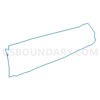
Outline

Summary
| Unique Area Identifier | 637607 |
| Name | Voting District 0400002 |
| County | Suffolk County |
| State | New York |
| Area (square miles) | 1.49 |
| Land Area (square miles) | 1.48 |
| Water Area (square miles) | 0.01 |
| % of Land Area | 99.31 |
| % of Water Area | 0.69 |
| Latitude of the Internal Point | 40.85649970 |
| Longtitude of the Internal Point | -73.45289420 |
Maps


Graphs
Select a template below for downloading or customizing gragh for Voting District 0400002, Suffolk County, New York


Neighbors
Neighoring Voting District (by Name) Neighboring Voting District on the Map
- Voting District 0400029, Suffolk County, NY
- Voting District 0400030, Suffolk County, NY
- Voting District 0400033, Suffolk County, NY
- Voting District 0400045, Suffolk County, NY
- Voting District 0400110, Suffolk County, NY
- Voting District 0400160, Suffolk County, NY
- Voting District 0400168, Suffolk County, NY
- Voting District 0513035, Nassau County, NY
- Voting District 0513064, Nassau County, NY
Top 10 Neighboring County Subdivision (by Population) Neighboring County Subdivision on the Map
Top 10 Neighboring Place (by Population) Neighboring Place on the Map
- Huntington CDP, NY (18,046)
- Woodbury CDP, NY (8,907)
- West Hills CDP, NY (5,592)
- Cold Spring Harbor CDP, NY (5,070)
- Laurel Hollow village, NY (1,952)
Top 10 Neighboring Unified School District (by Population) Neighboring Unified School District on the Map
- South Huntington Union Free School District, NY (38,650)
- Syosset Central School District, NY (34,200)
- Cold Spring Harbor Central School District, NY (8,556)
Top 10 Neighboring State Legislative District Lower Chamber (by Population) Neighboring State Legislative District Lower Chamber on the Map
Top 10 Neighboring State Legislative District Upper Chamber (by Population) Neighboring State Legislative District Upper Chamber on the Map
Top 10 Neighboring 111th Congressional District (by Population) Neighboring 111th Congressional District on the Map
Top 10 Neighboring Census Tract (by Population) Neighboring Census Tract on the Map
- Census Tract 1119, Suffolk County, NY (5,592)
- Census Tract 1101.02, Suffolk County, NY (5,070)
- Census Tract 1102, Suffolk County, NY (5,021)
- Census Tract 5182.01, Nassau County, NY (4,435)
- Census Tract 5182.03, Nassau County, NY (4,377)